News

Survey - Sofia Offshore Wind Farm
Fugro are due to commence Offshore Site Investigations along the export cable corridor and turbine array of the Sofia Offshore Wind Farm (SOWF), from the 28th March until July 2020.
Fugro will be undertaking Geotechnical Investigations along the SOWF export cable corridor. In the previous bulletin the start date was anticipated to be 13th March for the Despina. This has been delayed due to weather, but the Despina is planned to be on site before the end of March, provisionally around the 28th March. Works undertaken by the Despina are anticipated to take a month to complete, dependent on weather conditions.
Due to the Despina having limited manoeuvrability whist working in DP mode, it is requested that all vessels operating within this area maintain a safe operational distance, in line with standard procedures i.e. a C.P.A of 500 m, which is included in the survey area buffer of 2,000 m (coordinates below).
Fugro will continue geophysical operations along the export cable corridor and within the offshore turbine array using the Fugro Venturer and the Fugro Pioneer, with works expected to commence at the start of April 2020 and continue through July 2020. Vessels engaged in geophysical survey operations will deploy survey equipment behind the stern of a vessel and will require a large turning area, as detailed within the relevant Notices to Mariners (NTM’s).
Fugro requests a minimum of a 2000m safety zone during geophysical survey operations and all vessels operational in the vicinity should pass at a decreased speed to reduce vessel wash.
The geotechnical vessel ‘Despina’ and geophysical survey vessels will be undertaking survey operations on a 24 hour basis, with the guard vessel ‘Margaret Mary’ providing additional support where necessary. All vessels can be contacted on VHF channel 16 throughout the works for any further information.
The following vessels will be operational on site during these works
|
Type of Vessel |
Vessel Name |
Call Sign |
MMSI Number |
| Geotechnical Survey Vessel | Despina | LAKW7 | 259027000 |
| Geophysical Survey Vessel | Fugro Venturer | C6CG3 |
311000463 |
| Geophysical Survey Vessel | Fugro Pioneer | CBH3 | 311000262 |
|
Guard Vessel |
Margaret Mary |
MGNM6 |
232025575 |
For general enquiries related to Sofia Offshore Wind Farm you can e-mail comms_sofia@innogy.com or telephone: 03301 229670. Further contact details for the Fugro Project Manager and Project Fisheries Liaison Officer are detailed below.
For further information: Sally Dalrymple, Fugro, Tel: +44 7917 058751, email: s.dalrymple@fugro.com;
Nigel Proctor (FLO) Precision Marine Survey Ltd Tel: +44 7702 730891, email n.proctor@precisionmarine.co.uk
See detailed map on our bulletin website
Landfall survey for Dogger Bank (A&B) Wind Farms
Over water survey investigations are planned from 31 March 2020 until 15 May 2020 (weather dependent). The investigation will involve multiple vessels across the site.
Fugro has been contracted to provide a Marine Ground Investigation for SSE, approximately 8km South of Bridlington for a proposed cable landfall.
The fieldwork consists of 3 Work Elements:
- Work Element 1 – Geophysical Clearance Survey of the cable landfall and nearshore area. 31st March until 23rd April
- Work Element 2 – Nearshore Geotechnical borehole drilling from a jack up barge. Acquisition of geotechnical data at 5 or 6 locations along the cable landfall route. 23rd April until 1st May
- Work Element 3 – Subsurface Geophysical Survey. Acquisition of sub-seabed geophysical information across the cable landfall route. 4th May until 14th May
Work Element 1
- The Geophysical Clearance Survey will be performed by the Fugro Seeker, a 12m LOA (Length Overall) purpose-built survey vessel.
- The vessel will be mobilised in, and all operations and surveys run from, Scarborough.
- A transit route to site of ~26 nautical miles.
- This Work Element is expected to take approximately 5 days (not including weather delays).
Work Element 2
- The Nearshore geotechnical site investigation shall be complete from the Haven Seariser 4, a jack up barge of 29m LOA.
- The proposed site investigations are scheduled along the cable landfall route
- This Work Element is expected to take approximately 10 days (not including weather delays).
- Operations will continue on a 24hr basis.
- The Jack-up barge will be lit to allow night time operations and display RED_WHITE_RED lighting/shapes to indicate that it is a vessel restricted in her ability to manoeuvre.
- Vessels should keep clear of the jack-up barge at all times and are requested to not approach within 50m.
- Crew will transfer twice a day in the support RHIB, from the jack up barge directly to Bridlington Harbour.
Work Element 3
- The Subsurface Geophysical Survey will be performed from 2no. 9m LOA covered RHIBs.
- This Work Element is expected to take approximately 13 days (not including weather delays).
- The RHIBs will transfer to site daily from Bridlington Harbour.

Survey - Hornsea Two
A Benthic survey for the Hornsea Project Two Offshore Wind Farm using the vessel "DSV Curtis Marshal Callsign: 2HWN3" from 24th March until end April 2020.
Ørsted will be carrying out benthic surveys using the DSV Curtis Marshall Call Sign: 2HWN3 in the Hornsea Project Two wind farm array.
The surveys are expected to commence on or shortly after 24th March 2020 and may last until the end of April 2020. The exact survey dates are dependent on weather and work progress. When the works are complete, this Notice will be updated and re-issued.
The vessel will be towing a subsea camera system and may be undertaking grab sampling. As such, the vessel will have limited manoeuvrability and it is requested that all vessels operating near the vessels maintain a safe distance (at least 500m) and pass all vessels at minimum speed.
See detailed map on our bulletin website
Survey - Western Isles Cable Inspections (Central Element)
Briggs Marine Contractors (on behalf of SHEPD) will be undertaking hydrographic surveys to a number of subsea electricity cables within a 1km wide corridor. From 2nd April 2020 for 28 Days
The work will utilise the inshore survey vessel Mersey Guardian Call Sign: 2FGL4 and offshore survey vessel Topaz Tiamat Call Sign:V7A2125 for the operations.
See detailed map on our bulletin website
Survey - Western Isles Cable Inspection (Southern Element)
Briggs Marine Contractors (on behalf of SHEPD) will be undertaking hydrographic surveys to a number of subsea electricity cables within a 1km wide corridor. From 2 April 2020 for 28 Days
The work will utilise the inshore survey vessel Mersey Guardian Call Sign: 2FGL4 and offshore survey vessel Topaz Tiamat Call Sign:V7A2125 for the operations.
See detailed map on our bulletin website
Survey - Western Isles Cable Inspections (Northern Element)
Briggs Marine Contractors (on behalf of SHEPD) will be undertaking hydrographic surveys to a number of subsea electricity cables within a 1km wide corridor. From 2 April 2020 for 28 Days
The work will utilise the inshore survey vessel Mersey Guardian Call Sign: 2FGL4 and offshore survey vessel Topaz Tiamat Call Sign:V7A2125 for the operations.
See detailed map on our bulletin website
UXO Survey (Neart na Gaoithe Wind Farm)
A UXO Survey is continuing along the wind farm export cable route (until 18 May 2020) using the vessel "Glomar Wave" (call sign: 3FX4)
| Vessels |
Survey Area |
Duration |
|
Potential UXO Inspection survey: Glomar Wave 3FXF4
Guard vessel: Artemis MVIX5 Tranquillity S MJUH9 or Seagull MVBO2
|
Cable Route 56° 14.349' N 2° 18.237' W 55° 57.734' N 2° 22.472' W 55° 57.603' N 2° 23.199' W 55° 57.757' N 2° 23.301' W 55° 57.866' N 2° 22.729' W 56° 00.990' N 2° 21.938' W 56° 01.017' N 2° 22.262' W 56° 02.498' N 2° 21.882' W 56° 02.475' N 2° 21.561' W 56° 14.546' N 2° 18.479' W |
02/12/2019 - 18/05/2020 |

Construction of Wind Farm (Neart na Gaothie)
Activities are continuing related to the development of the Neart na Gaothie wind farm.
Survey
1 Month Survey, due to commence on 17 March 2020 within the bundary of the wind farm using the vessel "Fugro Mercator" (call sign: C6DU5).
Guard vessel: Artemis (MVIX5), Tranquillity S, (MJUH9) or Seagull (MVBO2).
UXO
During a UXO inspection survey within the boundaries of the Neart na Gaoithe Offshore Wind Farm Site and Cable Route, a number of confirmed UXO (cUXO) targets have been identified so far. The cUXO target locations identified between 12 December 2019 and 7 January 2020 are provided in the table below.
A 50m exclusion zone is requested at each of these locations.
| Latitude | Longitude | Description | |||
|
|
|
Buoyage
Five special markers are now in position:
| Name | Location |
|
SP 1 - Special Mark - Fl Y 5s light character |
56°18.180'N 02°12.075'W |
|
SP 2 - Special Mark - Fl Y 5s light character |
56°15.643'N 02°09.329'W |
|
SP 3 - Special Mark - Fl Y 5s light character |
56°12.294'N 02°15.796'W |
|
SP 4 - Special Mark - Fl Y 5s light character |
56°14.038'N 02°18.975'W |
|
SP 5 - Special Mark - Fl Y 5s light character |
56°18.924'N 02°18.951'W |
Four cardinal buoys are due to be deployed the week commencing 16th March. Planned deployment locations
| Name | Location |
|
NNG - North Cardinal - Quick (Q) white light character |
56°20.425'N 02°14.617'W |
|
NNG - East Cardinal - Q (3) 10 s white light character |
56°14.329'N 02°08.558'W |
|
NNG - South Cardinal - Q (6) + Long (L) FL 15 s white light character |
56°12.294'N 02°09.760'W |
|
NNG - West Cardinal - Q (9) 15 s white light character |
56°17.057'N 02°21.084'W |
A steel chain will be connected to each marker buoy, and the chain will be present through the water column, connected to an anchor placed on the seabed.
See detailed map on our bulletin website
Construction of Wind Farm (Triton Knoll)
Activities are continuing related to the development of the Triton Knoll wind farm. For background information visit: http://www.tritonknoll.co.uk/
Vessels will be operating as follows:
|
Vessel Name |
Type |
Call Sign |
MMSI |
IMO |
Operating Port |
Commence Date |
|
Sorrento |
Guard Vessel |
SXLE |
235087639 |
N/A |
Grimsby |
28/12/19 |
|
Precision 1 |
Guard Vessel |
2FCD2 |
235089165 |
N/A |
Hull |
28/12/19 |
|
Seacat Intrepid |
Crew Transfer |
2HWU6 |
235107284 |
N/A |
Grimsby |
01/01/20 |
|
Seaway Strashnov |
Heavy Lift Vessel |
5BNL2 |
212905000 |
9452701 |
Rotterdam |
01/01/20 |
|
Manta |
AHTS |
ORKJ |
205340000 |
9261487 |
Rotterdam |
01/01/20 |
|
Seraya |
AHTS |
9HA4875 |
248942000 |
9662368 |
Rotterdam |
01/01/20 |
| Esvagt Froude | Service Operations Vessel | OWWN2 | 219590000 | 9703461 | Grimsby | 02/02/20 |
| Esvagt Wind 1 | High Speed Craft | XPE6305 | 219019815 | N/A | Esvagt Froude | 02/02/20 |
|
Boka Falcon |
Boulder Clearance |
HP9176 |
370782000 |
9448401 |
Rotterdam |
13/02/20 |
| Dalby Don | Crew Transfer Vessel | 2IMZ6 | 235111112 | N/A | Grimsby | 18/02/20 |
| Guardian | Survey Vessel | PCFJ | 244750806 | N/A | Grimsby | 18/02/20 |
| Greenbarge 1 | North Sea Barge | N/A | N/A | 32120 | Newcastle | 14/03/20 |
| Centaurus | Towing Vessel for Greenbarge 1 | V2ED3 | 305820000 | 9433755 | Newcastle | 14/03/20 |
| EDT Hercules | Boulder Picking / Mattress Laying | 5BAM4 | 210776000 | 9491422 | Aberdeen | 24/03/20 |
| Terra Plana | Sand Wave Levelling | 5BBX5 | 209396000 | 9788746 | Grimsby | 27/03/20 |
| Greenbarge 3 | North Sea Barge | N/A | N/A | LG7125 | Antwerp | 29/03/20 |
| Centaurus | Towing Vessel for Greenbarge 3 | TBC | TBC | TBC | Antwerp | 31/03/20 |
| Boka Atlantis |
Boulder Clearance / Mattress Installation |
V7SG3 | 538003646 | 9441221 | Vlissingen | 23/03/20 |
| Voe Vanguard |
Pre-Lay Grapnel Run |
MBEN9 | 232008636 | 9809693 | Grimsby | 01/04/20 |
| Zwerver 3 |
Mass Flow Excavation |
PCLQ | 246024000 | 9614878 | Vlissingen | 06/04/20 |
| Thor | Jack Up Vessel | DIAV2 | 218389000 | 9577147 | Vlissingen | 16/04/20 |
| Ndurance |
Cable Installation |
5BVH3 | 09851000 | 9632466 | Rotterdam | 02/05/20 |
All Vessels Can be Contacted Via VHF 16 When Infield
Activities planned for the next 7 days:
- Guard Vessel “Sorrento” continues infield monitoring activities.
- Anchor Handling Vessels “Manta” and “Seraya” support foundation installation with 8 point mooring spread installation / recovery.
- Heavy Lift Vessel “Seaway Strashnov” to continue foundation installation works infield at locations “TK-G09” (OSPW) and then relocate to“TK-F18” (OSPE) for installation works.
- Crew Transfer Vessel “Seacat Intrepid” operating on site as required from Grimsby.
- Boulder clearance vessel “Boka Falcon” carrying out boulder clearance works within the TKOWF boundary.
- Service Operations Vessel “Esvagt Froude” infield supporting construction operations.
- Crew Transfer Vessel “Dalby Don” infield supporting “Boka Falcon” activities.
- Survey Vessel “Guardian” continues pre installation survey operations across the proposed cable locations.
- Towing tug “Centaurus” infield with North Sea Barge “Greenbarge 1” carrying OSPW & OSPE foundation components. Working closely with Seaway Strashnov.
- Anchor Handling Vessel “Afon Wen” infield to carry out interim surveys of the perimeter demarcation buoys.
*** Note ***
Application of Triton Knoll Wind Farm Safety Zones During Construction
The Secretary of State has granted the Application of Safety Zones on the Triton Knoll Wind Farm Project as follows:
- 500m “rolling” safety zones around any structure where construction is being undertaken (as indicated by the presence of construction vessels).
- 50m pre-commissioning safety zones surrounding partial structures or completed structures prior to commissioning.
Buoys
Partrac Ltd. deployed an additional x3 Demarcation Buoys and x1 Metocean Buoy (Figure 1) at the Triton Knoll Offshore Wind Farm (TKOWF) on 24th November 2019 using the vessel THV Galatea operated by Trinity House.
Vessels are requested to leave a wide berth during the installation operations. The buoys will be deployed for a period of two years, and all equipment will be removed at the end of the installation.
South Cardinal buoys TK01 and TK05 described in the table below have been recovered from Triton Knoll Offshore Wind Farm for maintenance by the vessel – “Afon Wen”.
Guard Vessel “Sorrento” has been placed in the general vicinity as a mitigation measure until such a time the buoyage is reinstated.
|
Buoy |
Structure |
Latitude |
Longitude |
Individual Specification |
|
TK01 |
South Cardinal |
53°24.054'N |
000°57.935'E |
Pillar shaped with a south cardinal shaped top mark, exhibiting a Q (6) + L Fl 15s light character (5 nm nominal light range) RECOVERED |
|
TK02 |
Special Mark |
53°24.568'N |
000°54.433'E |
Pillar shaped with a yellow ‘x’ shaped top mark, exhibiting a Fl Y 5s light character (5 nm nominal light range) |
|
TK03 |
Special Mark |
53°26.132'N |
000°50.008'E |
Pillar shaped with a yellow ‘x’ shaped top mark, exhibiting a Fl Y 5s light character (5 nm nominal light range) |
|
TK04 |
Special Mark |
53°27.457'N |
000°45.927'E |
Pillar shaped with a yellow ‘x’ shaped top mark, exhibiting a Fl Y 5s light character (5 nm nominal light range) |
|
TK05 |
South Cardinal |
53°28.859'N |
000°41.181'E |
Pillar shaped with a south cardinal shaped top mark, exhibiting a VQ (6) + L Fl 10s light character (5 nm nominal light range) RECOVERED |
|
TK06 |
Special Mark |
53°30.807'N |
000°41.826'E |
Pillar shaped with a yellow ‘x’ shaped top mark, exhibiting a Fl Y 5s light character (5 nm nominal light range) |
|
TK07 |
North Cardinal |
53°32.196'N |
000°44.248'E |
Pillar shaped with a north cardinal shaped top mark, exhibiting a Very Quick (VQ) light character (5 nm nominal light range) |
|
TK08 |
Special Mark |
53°32.444'N |
000°47.678'E |
Pillar shaped with a yellow ‘x’ shaped top mark, exhibiting a Fl Y 5s light character (5 nm nominal light range |
|
TK09 |
North Cardinal |
53°32.428'N |
000°52.040'E |
Pillar shaped with a north cardinal shaped top mark, exhibiting a Q light character (5 nm nominal light range) |
|
TK10 |
Special Mark |
53°29.595'N |
000°55.306'E |
Pillar shaped with a yellow ‘x’ shaped top mark, exhibiting a Fl Y 5 second (s) light character (5 nm nominal light range) |
|
TK11 |
Special Mark |
53°26.979'N |
000°57.974'E |
Pillar shaped with a yellow ‘x’ shaped top mark, exhibiting a Fl Y 5s light character (5 nm nominal light range) |
|
TK12 |
East Cardinal |
53°24.368'N |
001°00.228'E |
Pillar shaped with an east cardinal shaped top mark, exhibiting a Q (3) 10s light character (5nm nominal light range) |
|
TK13 |
Metocean Buoy |
53°26.002'N |
000°55.091'E |
Triaxys metocean wave and current buoy (South) exhibiting a Fl (5) Y 20s light character (3 nm nominal light range) |
|
TK14 |
Metocean Buoy |
53°30.581'N |
000°47.944'E |
Triaxys metocean wave and current buoy (North) exhibiting a Fl (5) Y 20s light character (3 nm nominal light range) |
See detailed map on our bulletin website

Survey - Hornsea Project Four
Hornsea Project Four will be carrying out offshore geophysical surveys from 20 March 2020 (weather dependent) for the proposed Hornsea Project Four Offshore Wind Farm located within the UK Sector of the North Sea, off the coast of East Yorkshire.
Ørsted will be carrying out a geophysical survey with the vessel Geo Ocean IV for the Hornsea Project Four Wind Farm.
A local scout/pilot vessel (Moremma) will also be contracted to reduce any potential interactions with static fishing gear markers.
The operations are planned to commence on or around 20 March 2020 and last approximately 2 weeks. The exact survey dates are dependent on weather and work progress, but the forecasted completion date as of the publication date of this notice is the end of April 2019.
The survey areas will be covered using a full geophysical survey spread including towed equipment which may be up to 400m behind the vessel. It is requested that all vessels operating within the area keep a safe distance (750m) and pass at minimum speed.
Survey Vessel: Geo Ocean IV
Call Sign: LXHD
Sat Phone: +32 (0) 4769 208 75
See detailed map on our bulletin website
Boulder Clearance - Hornsea Project Two
Boskalis will be carrying out boulder clearance on behalf of Hornsea Project Two along the proposed export cable routes using the Boka Falcon from 22nd March 2020
|
Company Vessel & Call Sign |
Survey Area | Duration | |
|
Orsted Boka Falcon HP9176 Titan Endeavour 2ELT9 |
|
22 nd March 2020 |
See detailed map on our bulletin website

Survey - Sheringham & Dudgeon Offshore Wind Farm
A 60 day survey geophysical survey will be conducted on the proposed Sheringham Shoal and Dudgeon Extension offshore windfarm on the North Norfolk coast
| Company | Vessels |
Area |
Duration | |
|
Equinor ASA |
Ocean Endeavour GAAL
|
|
01/04/2020 For 60 Days |

Cable Repairs - IFA 2 Interconnector Project
Cable works for the IFA2 project are continuing at KP170.3 of IFA2 RPL (50°39.117'N 000°50.855'W)
Cables Repair works of the HVDC bundle in the vicinity of KP170 are continuing.
The Jack up ring Brave Tern will be deploying 2 yellow cable marker buoy approx. 150m apart and from each one a line 15m long with A4 buoys attached. It is expected that one will be placed in the water on 17/18 March 2020 and it is anticipated that they will remain in situ for at least two weeks.
Vessels should pass at a safe speed and distance (approximately 500 metres) from all construction and support vessels. During these works the vessels will have restricted maneuverability as they complete their work scope.
Deployed Guard Vessels will monitor the exposed areas of cable while works progresses and advise of safe distances locally.
See detailed map on our bulletin website
Construction of wind farm (Moray East)
Due to the construction of the Moray East Offshore Wind Farm, there are several elements to this notice - safety zones; construction schedule; and buoy positions.
For background information about Moray East, please visit: www.morayoffshore.com/moray-east
Safety Zones
Please be advised that the Scottish Ministers have authorised the use of the safety zones during construction and operation of the Moray East Offshore Wind Farm as detailed below.
During construction
- A 500 metre radius around each WTG and OSP where construction works are taking place that include sensitive activities being undertaken by vessels RAM. A maximum of three of such zones is permitted at any one time.
- A 50 metre radius around partially completed WTGs and OSPs where work is not underway and the risk assessments identify a need.
- A 50 metre radius around each completed WTG and OSP prior to commissioning and as required by a risk assessment process.
During major maintenance
- A 500 metre radius around all major maintenance works being undertaken around the WTGs and OSPs. No more than one major maintenance zone is permitted at any one time.
Construction Activities
It is currently anticipated that weather permitting offshore construction works will be carried out on a continuous basis (i.e. 24 hour working, seven days a week) unless notified otherwise.
Please be aware that by virtue of its mode of operation and the equipment deployed, the MV Apollo and the MV Normand Service will be Restricted in their Ability to Manoeuvre as defined under COLREGS (International Regulations for Preventing Collisions at Sea 1972, Rule 3). Masters of vessels are therefore requested to maintain their vessels and gears at a minimum safe distance from these vessels of 500 metres when they are undertaking it work and showing the appropriate shapes and lights. Further Notice to Mariners will be issued as construction progresses.
|
Company, Vessel & Call Sign |
Survey Area |
Survey Area |
Start Timeframe & Duration |
|
GeoSea MV Apollo LXBP |
58°13.261'N 02°34.267'W 58°08.003'N 02°34.182'W 58°03.878'N 02°54.747'W |
58°12.529'N 02°52.563'W 58°19.425'N 02°44.191'W |
1 May 2019 for approximately 11 months |
|
GeoSea MV Normand Service LAFR8 |
As above |
As above |
As above |
|
Kinnaird Marine GV Replenish MASY7 |
As above |
As above |
As above |
|
Kinnaird Marine GV Resolute MLPD5 |
As above |
As above |
As above |
|
Kinnaird Marine GV Ability MDFW3 |
As above |
As above |
As above |
See detailed map on our bulletin website

Exposed Cables - Galloper Offshore Wind Farm
There was evidence of some short sections of cable exposure in 2 areas along the below cable routes in the North Field of the Galloper windfarm.
| Area | Start | Stop |
| E4H - E5H | 51°54.963'N 002°01.325'E | 51°54.384'N 002°01.224'E |
| OSP - F3C | 51°57.105'N 002°01.213'E | 51°58.309'N 002°03.799'E |
There is no cable exposure evident in the South Field of the windfarm.
See detailed map on our bulletin website
Dogger Bank - Survey
The work will be performed in the Dogger Bank Project A (formerly Creyke Beck A), Dogger Bank Project B (formerly Creyke Beck B) Dogger Bank Project C (formerly Teesside A) project areas, and along the project A&B offshore export cable corridor to Ulrome
Geo will be performing geotechnical operations on behalf of Dogger Bank Offshore Wind Farm. The vessel “Wilson Adriatic” Call Sign: OYOJ2 will conduct operations within the period 13th March to 31st May 2020.
See detailed map on our bulletin website
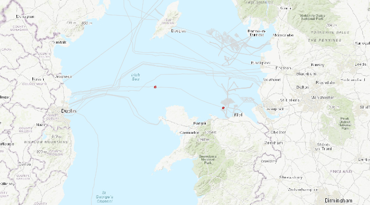
Cable Installation - Havhingsten (Irish Sea)
Subject to granting of all necessary licences and permits (expected March 2020), installation of the Havhingsten fibre optic telecommunication cable system is planned to commence, at the earliest, from April 2020 onwards.
The supplier of the Havhingsten cable is Alcatel Submarine Networks (ASN). Intertek are the environmental and permitting consultants.
The entire cable system will comprise marine elements that pass from Denmark to the UK (NE region); from the UK (NW) to the Republic of Ireland; with two segments being installed into landfalls on the Isle of Man.
The proposed NW cable route
Landfall will be made at Squires Gate Lane and the cable will include two branches into the Isle of Man.
Installation will be via industry standard burial tools including water jetting and ploughing. Target cable burial depth is 1.5m below seabed level in the Irish Sea region.
It is anticipated that installation operations in UK waters will occupy up to a maximum 500m width of the seabed (250m either side of cable). The cable itself will occupy only 40mm of the seabed.
Expected speed of installation will be 17 km per day. With the planned installation taking approx. 19 days.
There will be also be associated rock placement operations post cable installation at one (1) location within UK waters listed below.
|
Rock Placement Location Name |
Latitude |
Longitude |
|
Western HVDC Crossing Segment 1.5 |
53° 45.9867’ N |
003° 48.9137’ W |
Vessels will be working throughout 24 hours and will display appropriate day shapes and lights during reduced visibility and night operations.
Details of vessels proposed to be used are provided below:
Cable Installation Vessel: Ile de Batz (known as Ile de Class)
DP Type
Length Overall: 140.36 m
Breadth: 23.40 m
Cable Installation Support Vessel: Ile d’Aix
Installation support vessel working on shore ends and post-lay inspection and burial
Length Overall: 151.54 m
Breadth: 21.60 m
FFPV Nordnes (Rock Placement Vessel)
DP Type
Length Overall: 167 m
Breadth: 26 m
The proposed cable route in the IoM region
The cable route is proposed to cross the Irish Sea from Loughshinny (north of Dublin in Ireland) to Squires Gate Lane (south of Blackpool on the west coast of the UK). This section of the cable route will include two branches into the Isle of Man. With landfalls at Port Erin and Port Grenaugh.
Installation will be via industry standard burial tools including water jetting and ploughing. Target cable burial depth is 1.5m below seabed level in the Irish Sea region.
It is anticipated that installation operations in UK waters will occupy up to a maximum 500m width of the seabed (250m either side of cable). The cable itself will occupy only 40mm of the seabed.
Expected speed of installation will be 17 km per day. With the planned installation taking approx. 7.5 days.
Currently there are no proposed rock dump sites within the IoM region.
There will be also be associated rock placement operations post cable installation at the two (2) locations within IoM waters listed below.
|
Rock Placement Location Name |
Latitude |
Longitude |
|
Western HVDC Crossing Segment 1.2 |
54° 54.7007’ N |
004° 58.3552’ W |
|
Western HVDC Crossing Segment 1.4 |
53° 53.8396’ N |
004° 34.1792’ W |
All fishing vessels are requested to maintain an appropriate and safe distance of 500 m when passing the cable installation vessels whilst operational and should pass at the lowest possible speed to avoid vessel wash effects.
Vessels will be working throughout 24 hours and will display appropriate day shapes and lights during reduced visibility and night operations.
Details of vessels proposed to be used are provided below:
Cable Installation Vessel: Ile de Batz (known as Ile de Class)
DP Type
Length Overall: 140.36 m
Breadth: 23.40 m
Cable Installation Support Vessel: Ile d’Aix
Installation support vessel working on shore ends and post-lay inspection and burial
Length Overall: 151.54 m
Breadth: 21.60 m
See detailed map on our bulletin website
Cable Installation - Havhingsten (North Sea)
Subject to granting of all necessary licences and permits (expected March 2020), installation of the Havhingsten fibre optic telecommunication cable system is planned to commence, at the earliest, from April 2020 onwards.
The supplier of the Havhingsten cable is Alcatel Submarine Networks (ASN). Intertek are the environmental and permitting consultants.
The entire cable system will comprise marine elements that pass from Denmark to the UK (NE region); from the UK (NW) to the Republic of Ireland; with two segments being installed into landfalls on the Isle of Man.
The proposed cable route in the NE.
Landfall will be made at Seaton Sluice.
Installation will be via industry standard burial tools including water jetting and ploughing. Target cable burial depth is 2m below seabed level in the North Sea region.
It is anticipated that installation operations in UK waters will occupy up to a maximum 500m width of the seabed (250m either side of cable). The cable itself will occupy only 40mm of the seabed.
Planned durations of works are as per below:
- Seaton Sluice: Nearshore to 12nm Territorial Waters boundary: 3-4 days (including 1 day for shore end landing)
- Seaton Sluice: 12nm Territorial Waters boundary to EEZ boundary (median line): 22 days (including 4 x pipeline crossings)
Expected speed of installation will be 17 km per day.
There will be also be associated rock placement operations post cable installation at the four (4) locations within UK waters listed below. There will also be associated pre-lay rock placement at CATS and Shell pipelines.
|
Rock Placement Location Name |
Latitude |
Longitude |
|
Shearwater to Bacton |
55 ° 30.7307' N |
01° 34.1312' E |
|
Sleipner to Easington |
55° 22.3285' N |
0° 40.8843' E |
|
Norpipe Pipeline |
55° 19.1729' N |
0° 16.0142' E |
|
Cats Pipeline |
55° 15.8120' N |
0° 21.9184' W |
All fishing vessels are requested to maintain an appropriate and safe distance of 500 m when passing the cable installation vessels whilst operational and should pass at the lowest possible speed to avoid vessel wash effects. Vessels will be working throughout 24 hours and will display appropriate day shapes and lights during reduced visibility and night operations.
Details of vessels proposed to be used are provided below:
Cable Installation Vessel: Ile de Batz (known as Ile de Class)
DP Type
Length Overall: 140.36 m
Breadth: 23.40 m
Cable Installation Support Vessel: Ile d’Aix
Installation support vessel working on shore ends and post-lay inspection and burial
Length Overall: 151.54 m
Breadth: 21.60 m
FFPV Nordnes (Rock Placement Vessel)
DP Type
Length Overall: 167 m
Breadth: 26 m
See detailed map on our bulletin website
Survey - Hornsea Project One
Nearshore geophysical survey works will commence with Spectrum 2 on or about 22 February 2020
| Company | Vessels | Duration |
|
Orsted |
Spectrum 2 2GHE5 |
22/02/2020 For 4 Weeks |

Floating LiDAR Buoy - Moray OWF (West) Ltd
Mariners are advised that a Floating LiDAR Buoy, primarily measuring wind and metocean data, is deployed at a location in the centre of the Moray West Offshore Wind Farm Site.
|
The Floating LiDAR Buoy was deployed on 2nd December 2018 and is to remain in place until December 2020. |
Exposed Cable Sections - EirGrid East West Interconnector
Following a recent marine survey along the route of the EirGrid East West Interconnector power cable, is was found that the cable is currently exposed at two locations within UK 12-mile territorial waters fishery limit off the North Wales coast.
In the interests of maritime safety, mariners/fishermen are advised not to anchor, trawl or deploy bottom contact fishing equipment in the vicinity of the EirGrid East West Interconnector power cable route and within the boundary box of the exposed cable sections as detailed.
See detailed map on our bulletin website
Unexploded Ordnance
Hornsea Project Two has completed unexploded ordnance (UXO) investigations for the proposed Hornsea Project Two Offshore Wind Farm located within the UK Sector of the North Sea for 2019, off the coast of East Yorkshire.
Mariners are advised that Hornsea Project Two confirms the presence of 13 confirmed unexploded ordnance (UXO) as yet undetonated within the export cable corridor.
See detailed map on our bulletin website
Deployment of Marker Buoys - Nemo Link Cable
2 x Marker buoys have been deployed along the Nemo Link Cable
Marker buoys have been deployed at 2 locations along the Nemo Link subsea cable route approximately 8.5km and 17.5km East of Ramsgate at the following positions:
51°19.193'N 001°32.578'E
51°19.817'N 001°40.282'E
The buoys consist of a hull, day marker, mooring chain and sinker. The outer hulls and day marks are identified by yellow paint.
Fishermen and Mariners are requested to note the buoy locations and to maintain a safe distance during fishing and marine activities.
See detailed map on our bulletin website

Dropped objects on seabed
During recent maintenance work at Turbine position C06 several objects were dropped on the seabed. The biggest being a Bearing Transport Frame (1800mm x 2236mm x 830mm) weight – 947kg as well as 33m of steel Crane Wire and several smaller objects.
Show More

Cable spans
Surveys at Greater Gabbard show that there are 8 free-spans which are listed below.
|
Location |
Span Length (m) |
Span Height (cm) |
Start of Span |
End of Span |
|
L1 cable |
6 |
0 |
52° 12.284'N 001°39.364'E |
52°12.283'N 001°39.369'E |
|
L1 cable |
8 |
13 |
52° 12.271'N 001°39.434'E |
52°12.270'N 001°39.441'E |
|
L1 cable |
8 |
20 |
52° 12.064'N 001°40.559'E |
52°12.061'N 001°40.565'E |
|
L2 cable |
15 |
5 |
52° 12.128'N 001°40.524'E |
52°12.124'N 001°40.535'E |
|
L2 cable |
8 |
76 |
52° 12.119'N 001°40.560'E |
52°12.118'N 001°40.567'E |
|
L3 cable |
3 |
11 |
52° 12.169'N 001°40.502'E |
52°12.169'N 001°40.504'E |
|
L3 cable |
13 |
34 |
52° 12.148'N 001°40.594'E |
52°12.146'N 001°40.604'E |
|
L3 cable |
17 |
10 |
51° 59.194'N 001°57.431'E |
51°59.187'N 001°57.442'E |
Whilst the results continue to be processed, Balfour Beatty have asked that in the interest of safety and the integrity of the cable, extreme caution be used when Fishing near the export cables and that Fishermen refrain from using towed gear across the export cables wherever possible.
See detailed map on our bulletin website

Exposed sections of cable
Surveys at Gunfleet Sands offshore wind farm have illustrated that some array/in-field cables are lying exposed on the seabed and are no longer buried and there is one freespan. These may represent a hazard to fishing.
These are the following cables located in the eastern part of Gunfleet Sands 1 and the north eastern part of Gunfleet Sands 2.
|
Location |
Exposure Length (m) |
Start of Exposure |
End of Exposure |
|
Between turbines C06-D06 |
4 |
51°44.447'N 01°15.045'E |
51°44.445'N 01°15.046'E |
|
Between turbines F06-F07 |
23.7 |
51°44.204'N 01°16.057'E |
51°44.209'N 01°16.076'E |
|
Between turbines F07-F08 |
78.4 |
51°44.471'N 01°16.744'E |
51°44.448'N 01°16.688'E |
|
Between turbines F08-F09 |
851.7 |
51°44.485'N 01°16.777'E |
51°44.726'N 01°17.398'E |
|
Between turbines G06-G07 |
21.7 |
51°44.008'N 01°16.270'E |
51°44.002'N 01°16.255'E |
|
Between turbines G07-G08 |
21.9 |
51°44.273'N 01°16.948'E |
51°44.267'N 01°16.932'E |
|
Between turbines G08-G09 |
20.7 |
51°44.276'N 01°16.953'E |
51°44.280'N 01°16.969'E |
|
Between turbines G08-G09 |
16.6 |
51°44.522'N 01°17.591'E |
51°44.527'N 01°17.603'E |
There is a freespan at the following array Cable Position:
|
Location |
Exposure Length (m) |
Start of Exposure |
End of Exposure |
|
Between turbines C06-D06 |
4 |
51°44.447'N 01°15.045'E |
51°44.445'N 01°15.046'E |
See detailed map on our bulletin website

Exposed Export Cable (Beatrice Wind Farm)
During a routine inspection of the export cable EC2, a short section of the cable was found to be partially exposed on the Seabed. This may constitute a hazard to activities such as fishing and anchoring.
A short area (4metres) of partial exposure of Export Cable EC2 is in the vicinity of the mid cable joint at the location where the cable changes direction through 180 degrees.
The maximum exposure observed was approx. 50% with no damage or defects observed. The seabed at location was observed to be flat and featureless and mainly consisted of sand and silt. It is requested that mariners avoid activities which are likely to disturb the seabed within a 500m Radius of this location until the exposed cable has been re-buried. A further Notice to Mariners will be issued to confirm the re-burial and safe operation in this area.
See detailed map on our bulletin website


Exposed Cable Section (SHEFA)
There is an exposed section on the SHEFA cable coming out of Orkney between the two positions below.
Show More


Disclaimer
TO DOWNLOAD THIS FILE, YOU MUST AGREE TO THE TERMS AND CONDITIONS "TERMS" NOTED AT THE FOOT OF THIS WEBSITE WHICH APPLY TO YOUR USE OF THIS WEBSITE AND TO USE OF THE FILE YOU HAVE CLICKED TO DOWNLOAD. IF YOU DO NOT AGREE TO THE TERMS, YOU WILL NOT BE ABLE TO DOWNLOAD THE FILE AND YOU SHOULD NOT USE THIS WEBSITE. TO CONFIRM YOUR ACCEPTANCE OF THE TERMS AND TO COMMENCE THE DOWNLOAD OF THE FILE, PLEASE CLICK THE "DOWNLOAD" CHECK BOX. IF YOU DO NOT AGREE TO THE TERMS, PLEASE CLICK THE "CANCEL" BUTTON. YOUR ATTENTION IS DRAWN TO CONDITION 3 NOTED BELOW WHICH FORMS PART OF THE TERMS IN RELATION TO OUR LIABILITY TO YOU.
Agree and download Cancel